Saturday, February 11, 2023

Arches National Park

1/16/2023 - I took my time getting going upon my first morning in Moab. Since I awake at dawn naturally, this means getting out of bed at 0730 is sleeping in for me. But I was already pleased with the decision to stay at the Hyatt. Everything in the room was comfortable. It was quiet and relaxed, and breakfast was included. Breakfast was cooked each day and it tasted delicious. With a full belly, I was ready to attack the day and visit a place I had wanted to see for a long time: 

Arches National Park. 

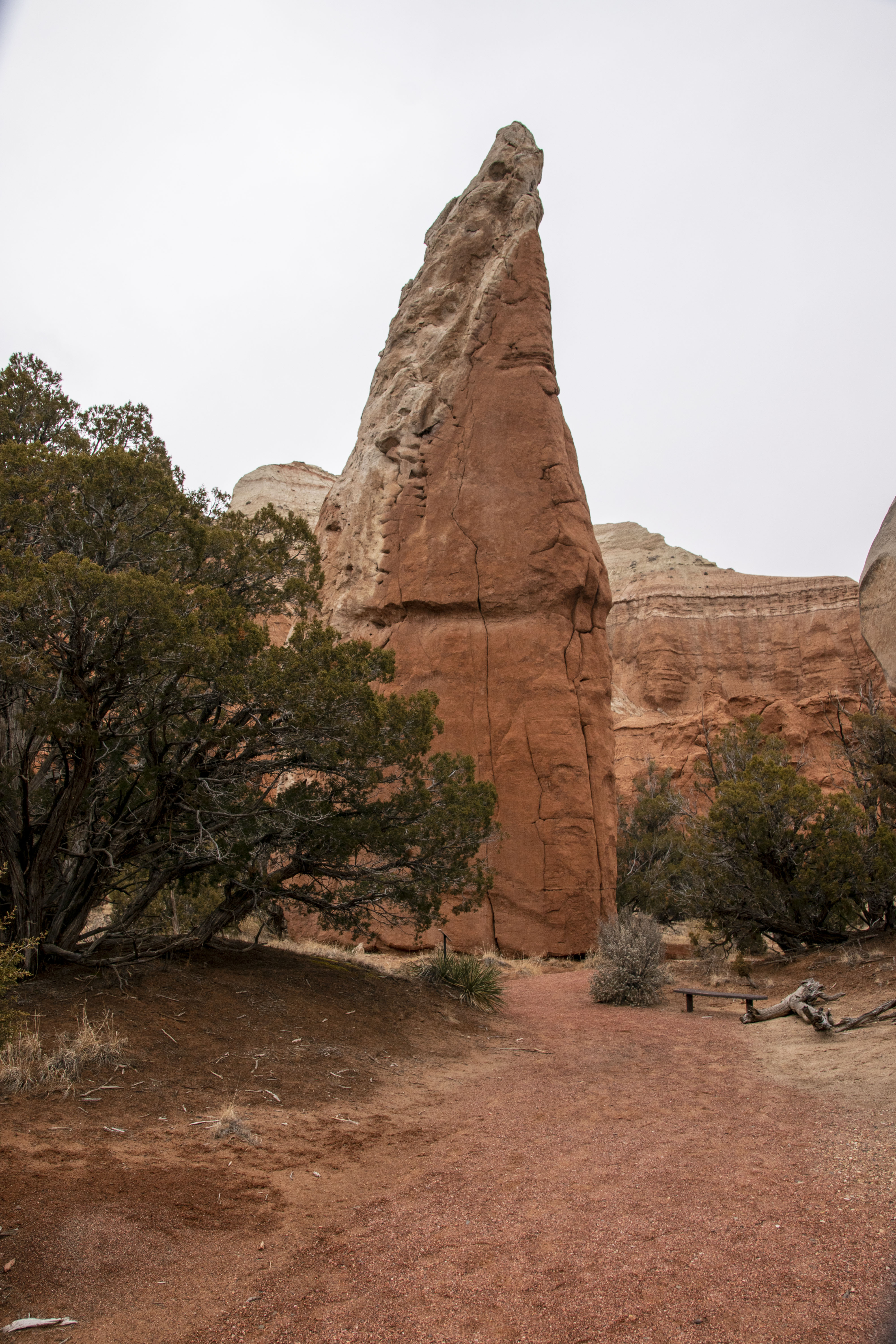
This was my first visit to Arches National Park, considered one of the Mighty 5 national parks in the state of Utah, along with Zion, Capitol Reef, Bryce Canyon and Canyonlands. Approximately 2,000 entrada sandstone arches are documented here, some tiny, some enormous. Most of the arches I saw were just that: holes in sandstone created from eons of erosion.


But there were two arches in particular that emitted some sort of energy: Delicate Arch and Double Arch. These formations are iconic to the park, massive arches that boggle the mind. I spent several hours at Delicate Arch and the bowl below it, photographing it and exploring the area. I can’t explain exactly what this energy was or where it comes from, but I noticed it. Perhaps it’s spiritual or cosmic. I spent a few minutes meditating and had the impression that my body’s energy was gently oscillating. It was a positive, calming energy. I felt at peace in that moment.

On the way back to the trailhead, I began to think about petroglyphs I had seen of a single oscillating line. Maybe the people of long ago had the same experience I had when they felt their body's energy oscillate while meditating near certain arches, so they drew that petroglyph to mark the spots for other people to find and have the same experience. It was my own little hypothesis in an attempt to make sense of something that does not make sense. 


Double Arch is another place I had only ever seen in books or on tv. It seems to be bigger in person. Set into a sort of alcove or cave, any sound echoes off the rock walls, giving off the impression of a giant room. I felt energy here too. I sat down and listened to the silence for a few minutes. I walked back to the car at dusk with a smile on my face, feeling stress free and grateful for the day.


In the summer of 2022, I read a book called Desert Solitaire by Edward Abbey. The book was about his season as a park ranger inside Arches National Park before it had paved roads taking tourists right up to the arches. He wrote about how much of a shame it was that the National Park Service was going to build paved roads in the park. These roads ruin the feel of wilderness in these parks, he argued. After visiting the park, I saw what he meant. Arches National Park does have some sort of energy. I could really feel it in certain areas I've already mentioned; it's a mystical place. I imagine that I would not be able to feel it if the park was too crowded with people. I wish the road didn't make the park so accessible; people should be required to hike more to see some of the arches. 


During my visit, I encountered rain, snow and wind. It was a cold, miserable day to be outside, but this seemed to keep a lot of people away. Arches is normally a very popular place to visit, so much so that the park has to limit how many people get to enter during the warmer months. I didn't have this issue during my January visit. I just flashed my park pass to the ranger at the entrance and drove up the steep switchbacks that lead people into the park proper. I think the lack of people contributed to my overall enjoyment. 

In addition to the energy I felt, the day was special because on two separate occasions a raven flew right up to me and allowed me to take its portrait. Perhaps they just thought I would give them food since tourists in the park probably do it all the time, but I had the feeling there was a deeper meaning.

These beautiful black and purple feathered birds are quite large up close. The first time it happened, I had hiked up to a viewpoint overlooking Delicate Arch, an icon of Arches National Park. There was no trail to this point. I had tenuously perched myself on the cliff edge to take photos of the arch. That’s when the raven flew up and landed about 4 feet behind me, spooking me. This bird was probably flying around the bowl and arch to other tourists. But this close? The raven’s beak was coated with red sand, as if it had been digging for food. It stayed on that rock for a few minutes, enough time for me to take its portrait. I talked to the raven. As soon as it flew off, I wondered what the meaning of it was.

The second instance was at the Devil’s Garden trailhead in the afternoon. I had returned from my 2 mile walk to Landscape Arch, the longest arch in the park. The trail leading directly underneath the arch is now closed due to safety reasons. In 1991, a 60-foot slab of rock broke off from the underside of the arch forcing hikers who had been sitting underneath it to flee, thus inspiring the closure. The trail now gives the arch a wide birth.


Two courting ravens were perched on branches near the parking lot. I heard one of them make a throaty sound; I later learned that the raven was singing. As I walked to my car, one flew down and landed in front of my car. The other soon followed. I crouched near my car facing them. Like with the first raven, I talked to these two, complimenting their colors and size. I asked if they were together. One flew up on the hood of my car and the other soon followed. They pecked at the leaves caught under the hood while I stood 3 feet away, photographing them. I noticed how purple some of their feathers were.


The two would talk, making cute honking sounds. They would affectionately nibble and scritch each other. I took a video and showed it to them. They seemed interested. As I sat in the driver seat, one flew up and perched on the open door. I gave both of them some peanuts from my trail mix. I had never had such an experience before and again wondered what this meant in the grand scheme of things.

Ravens can symbolize different things, positive and negative. The can be symbols of death and destruction in some cultures while in others they are seen as spirits in the mortal world acting as messengers. Some also see them as symbols of insight or rebirth. I'm still not sure exactly what they meant but considering the day I had in the park, I took it as a good sign that these ravens approached me and felt comfortable enough to talk.

I spent the entire day inside the park, thrilled with my spiritual experiences. I returned to Moab under cover of darkness, picking up some fast food and most importantly, some ice cream.

Sunday, February 5, 2023

Capitol Reef National Park, Factory Butte and Moab

1/15/2023 - While sleeping in my cozy motel in the tiny town of Boulder, a storm dropped about three inches of snow, blanketing the high-elevation landscape with powder snow. I had a feeling of anxiety after opening the front door first thing in the morning, knowing what happened the last time I drove in the snow in the Camry. On that occasion just a few weeks ago, I installed snow chains on my car that were probably too big for the tires and they caused damage to the front passenger wheel well and quarter panels.

But I packed the car, wiped off the snow from the roof and windows, warmed it up and set off, but not before taking photos of this winter wonderland. I had seen a plow truck roll past my motel keeping the road clear, so I felt better about setting off even with snow still falling.

As I made my way up Boulder Mountain, I began to wonder if I made a wise decision. The road was plowed save for a thin layer of ice and snow, but the visibility was degrading. My car was losing traction. I thought about the snow chains in the trunk and whether I should install them. I never saw anywhere to pull over and no pullouts free of a foot of fresh snow. If I stopped, it would have to be on the side of the two-lane highway. So, I kept going. There are several rules I've learned for driving in snowy, muddy, or sandy conditions: no sudden movements, use the engine to brake, do NOT stop. However, this strategy didn't stop me from questioning my own intelligence and decision making.

I reached Boulder Summit at 9,600 feet in elevation. I breathed a sigh of relief now that I’d be heading down the mountain where there would be less snow, but I wasn't out of the woods yet. I still had poor visibility on a windy and curvy mountain road. I kept the car in third gear, went slowly and stayed patient. Eventually the layer of snow and ice on the roadway gave way to asphalt. Soon I could see blue sky. Then there was no more falling snow. A few miles later, the road was dry. I reached the town of Torrey in a blaze of sunshine with my bedraggled car still icy, snowy and filthy from the journey down the mountain. I stopped in town to get myself a sandwich and chip all the snow and ice off the roof, sides and undercarriage. My car looked rough, but it helped me get out of a hairy situation.

I took a deep sigh of relief, paid for my sandwich, and then proceeded to my next destination: Capitol Reef National Park.

Capitol Reef is one massive cliff that runs 100 miles north to south, a fold in the earth’s crust. The landscape is disorienting because the layers of sandstone in the cliffs are slanted; I was reminded of a sinking ship. It was yet another bizarre landscape, like an alien world. The storm hadn't reached the park, but I still found evidence of recent snowfall with small patches of snow in shady spots. Parts of the red-orange cliffs were bathed in sunlight while others stayed in shadow. It seems this cliff runs on forever. The park gets its name from when early Mormon explorers encountered this intimidating natural obstacle. There was no way to scale the giant cliff face; it was like a reef blocking travelers' easy and safe passage.


I stopped at the visitor center and sat on a bench facing the cliff and a rock formation called The Castle. While munching on the turkey sandwich, I gazed at the colorful cliffs. The different colors in the layers come from different sediment deposits over millions of years in various climates and environments. Some layers used to be sand dunes in a vast desert. Other layers are tinged green from the days when this area was a soggy marsh. And over millions more years, wind and water slowly carved each nook and cranny of this rock, turning it into a vast natural wall. After finishing my sandwich, I wandered down scenic drive, a road that meanders about 10 miles along the base of the cliffs to give visitors a taste of the landscape.

I turned into a dirt road that leads into a canyon called Grand Wash, where I eventually stopped at the trailhead for Cassidy Arch. All along this dirt road are warning signs about the danger of flash floods. During monsoon season in July, August and September, heavy rains can create rivers and waterfalls in these desert environments. In fact, there was a massive flash flood in Capitol Reef in the summer of 2022. Since I live in Bishop, the monsoon season can get pretty wet as well.


The trail for Cassidy Arch climbs from the bottom of the canyon to the top, using countless stone stairs. It's not a long hike, only about three miles round trip, but it does feature elevation gain. The work is worthwhile though, because you're treated to many different colors in the cliffs as well as breathtaking views from the edge of the cliff. Cassidy Arch itself is somewhat tucked away. From far away, like in the bottom photo, it looks like the entrance to a large cave. You can't really tell it's an arch until you get right up close to it, almost on top of it. It's a lovely spot for lunch because there are plenty of places to sit and enjoy the views.

I chatted with several random strangers on this trail. The highlighter pink permit for my hike in the Paria Canyon-Vermillion Cliffs wilderness was still attached to my backpack, so that was a conversation starter. This was one of the most enjoyable things about this road trip: since I was traveling solo, I chatted with strangers on the hiking trails, hotel lobbies, bars, restaurants, etc. While at the arch, I asked a middle aged blond woman to take my photo on the arch, and she agreed.

A short time later, I returned to my car and grunted as I got into the driver seat, wiping sweat from my forehead. From Capitol Reef I continued east on Utah state route 24 and glimpsed formations such as Factory Butte. This part of Utah along State Route 24 is quite isolated and rural; you see few cars driving the opposite direction, making it an enjoyable road to drive. It meanders through tiny towns like Caineville and Hanksville and large mesas and buttes. Factory Butte seems to be an icon in this region as its shape dominates the high desert skyline. This is another formation that is well-known amongst photographers. I was pleased to see the cloud coverage above the butte and the patchy sunlight partly bathing it.


There isn't much in Hanksville besides a few homes and an opportunity to refuel. One resident created an art installation using rusty metal, so I stopped driving to take a look. While examining the artwork, I met a friendly cat that was all too happy to receive head scratches from a perfect stranger.

Farther along SR 24 from Hanksville, I began to see random rock spires in interesting shapes. This part of the highway was completely straight, running parallel to the San Rafael Swell, a rugged mountain chain in Central Utah. There wasn't much to see on the south side of this road, but I knew Canyonlands National Park was somewhere in that direction. As sunset rapidly approached, I connected with Interstate 70 and drove all the way to Moab, arriving in town after dark.

It was here in Moab where I treated myself to a nice hotel room at the Hyatt, intending to stay for two nights. Of course, I didn't make reservations days in advance since this was January. I strolled into the lobby and asked if there were any open rooms, paid the fee and then swiped my keycard. I laughed as I saw how comfortable and luxurious the room was.

That night, I sank into the queen size bed and slept soundly.


Saturday, February 4, 2023

Bryce Canyon National Park, Kodachrome Basin State Park and Utah State Route 12

1/14/2023 - My body was sore and stiff from a day of hiking on sandstone in North Coyote Buttes, so I had a slow start to the morning. My knees and ankles were especially sore. I took my time waking up and eating breakfast in the hotel in Kanab, savoring everything about what had already happened over the week. I also appreciated the fact that I had no plans for the rest of the road trip. I could go anywhere I wanted. My ultimate goal for the trip had been accomplished.
 
I drove north from Kanab on State Route 89 and eventually connected with State Route 12. This route is a relatively young one, having only been paved with asphalt in 1985. It’s a National Scenic Byway which leads drivers through some wild country that was some of the last in the United States to be surveyed and mapped. My absolute favorite part about this route was the total lack of other traffic; I could drive for an hour and encounter one other car. My second favorite part was when the road meandered on the top of a hilltop and then dove down to the bottom of Escalante River Canyon, like an eagle pursuing prey. It’s a shame that I drove this part at twilight because I couldn't fully appreciate it in all of it's wild glory.

I made two stops along this route. The first was Bryce Canyon National Park. Upon my arrival, I was greeted with flurries of snow. But once I had parked at Sunset Point and installed the snow chains for my hiking boots, I was happily trudging along the icy path and consuming the view of Bryce Canyon from that spot. In those moments, the storm broke and sunlight poke through the clouds, illuminating the scene before me creating a truly magical moment.

“Special conditions,” I repeated to myself in excitement.


I hadn’t planned on it, but I hiked down into the canyon using Navajo Trail. The snow chains were a big help, otherwise I would have slipped and went sliding down the canyon to my doom. Bryce Canyon is filled with orange hoodoos carved by water and wind over millions of years. Many of them look eerily like people. In fact, Native American legend says these were once actual people who were turned to stone by the gaze of the trickster coyote.

I strolled the icy switchbacks down Wall Street, dwarfed by the sandstone walls on either side. Occasionally the sun would reappear and make the orange walls glow. Snow sat on the tips and ledges of the walls and hoodoos like vanilla frosting. Bryce Canyon was another one of those places I had only ever seen in photos before. Seeing it with my own eyes in these conditions was spectacular.

I hiked all the way down into the canyon and stopped at a fork in the trail. I gathered my breath here and chatted with some fellow hikers before beginning the slog back up the canyon. If walking an icy trail downhill is difficult, the slog back uphill is even more so. I took my time, though, and reminded myself that easy does it. With each step back up the switchbacks my body got more into rhythm. Eventually I reached the rim of the canyon once again, exhilarated from a once-in-a-lifetime hike.

Afterwards, I drove to Kodachrome Basin State Park. I didn’t spend a lot of time there, but I did go on a nature walk and was greeted by a stone spire that looked suspiciously phallic. I had no idea this specific spire existed; I just knew Kodachrome Basin as a place with cool rock spires, almost 70 of them. It's an isolated state park as you have to drive about seven miles south of the tiny community of Cannonville and watch out for cattle crossing the road. It is yet another place for geology lovers.


But I didn't stay long. The sky was turning dark and gray, and rain began to fall. So I returned to Cannonville and turned back onto Utah State Route 12 where I drove for another few hours. I stopped at roadside information signs, such as the one that pointed out an ancient Native American storage structure high in the cliffs in an alcove, kind of like the homes Navajo National Monument preserves in Arizona. I drove through the community of Escalante and nearly hit some deer in town, the fourth one I had nearly hit that evening. Escalante looked like a nice little town with plenty of accommodation, but I kept going.

Since it was turning dark on this meandering road with bad cell reception and I had nearly hit four separate groups of deer in just a few miles, I decided to call it a day when I arrived in the tiny ranching town of Boulder. I stopped at the Circle Cliffs Motel where two men and a friendly cat took my reservation in the office, smelling strongly of marijuana.

I don't remember there being any restaurants or any place to buy food in Boulder, so I just enjoyed my own snacks that night and the hot chocolate from the motel, and the murder mysteries on the television.

Thursday, February 2, 2023

Hiking to The Wave

1/13/23 - This was it, the reason for this road trip. 

The day had come when I would hike to The Wave, an extraordinary geological feature in North Coyote Buttes of the Paria Canyon/Vermillion Cliffs Wilderness. I woke up before dawn and got ready in a state of excitement. My heart rate was faster than normal while I packed my things in the hotel room. I had trouble focusing on any one thing. I wolfed down a hearty breakfast in the hotel lobby and then walked towards my horse for the day: the 2022 Jeep Gladiator.

I had picked up the rented Jeep the night before from a local resident. He showed me how to shift the truck into four-wheel drive and gave me some advice regarding the road leading up to the trailhead, and how to find The Wave. The Bureau of Land Management includes a map with photos of landmarks to look out for along with the highlighter-pink permit when sent through the mail, but it is commonly dismissed by experienced hikers. He told me it isn't obvious as to where The Wave is. I told the guy I would be using GPS, which made him feel better. I hopped into the driver seat feeling as if I had just jumped into a tank. Not used to driving such a rugged vehicle, I gingerly drove it the three blocks to the hotel parking lot.

The Jeep was ready to go in the hotel parking lot in the morning, next to the Camry. I left Kanab when it was still dark, with a sliver of light and adventure on the horizon.

I reached Houserock Valley Road quicker than I anticipated. I began driving on this reddish dirt road during sunrise when pink streaked across the sky. The hills on the west side of the valley began to glow with early morning frigid January sunlight. 

There was a rainstorm a few days before my arrival. The rain actually damaged this road, undercutting the shoulders and eroding other parts of the road. Some parts were a muddy, sloppy mess. Others were submerged in large puddles of water. And other parts of the road were rough and bumpy. There were dips through washes. No matter what I came across, the Jeep handled it comfortably. I never had to shift into four-wheel drive, but I'm glad I had this machine. The Camry would have been beaten up by this road.


I found a reasonably large dirt parking lot at the trailhead complete with bathrooms, informational signs and a register. I packed my backpack with everything I would need, put on my orange Caltrans jacket over my highlighter-green shirt that I had received as a Christmas gift, and walked to the register where I signed my name, permit number, what time I started and what car I drove. While I did this, a sedan pulled into the parking lot, driven by a young kid in his early 20s. He and his girlfriend got out of the car, visibly shaken by the journey on that dirt road and wondering whether their car took damage. The guy shook his head saying, "never again." He and his girlfriend argued.

A permit is required to hike this trail. To get a permit, you must enter a lottery offered through the Bureau of Land Management. You can apply for up to three dates once a month and the lottery results are released on the first of the month. It costs $9 to enter the lottery. If you win the lottery, then you need to actually apply for the permit which costs $7. It then takes a month and a half for the BLM to mail the permit to you. Along with the permit, the BLM includes a map complete with landmarks to help you orient yourself, GPS coordinates, information on heat stroke and exhaustion, and an invitation to attend an orientation at a BLM office the day before the hike in Page or Kanab. 

The trail began with a 15-minute walk that followed the curve of a wide wash. Eventually I exited the wash via a trail on the south side that led over a hill, and the sandy path began to turn towards the south. There was no established, official trail on the way to The Wave. Hikers must be in decent shape, be able to scramble up and over rock, and be skilled in navigation. 


In the first mile or so of the hike, there were a couple of metal posts spread a few hundred feet apart indicating a hiker is headed in the correct direction. But they suddenly stop appearing. You're then left to your own devices in wilderness, surrounded by mind-blowing geology. It's easy to get lost. I sure did a couple of times. Before departing on the road trip, I downloaded a hiking app called Gaia. This app allows you to download trail maps for offline use. While on the trail, you can open a topographical map and see where you are in relation to the route. This map was immensely helpful to me a couple of times, especially in the moments when I was distracted by some weird formation I had never seen before. 

During one such time while I was finding my way back to the proper route, I found myself walking through an icy wash. My foot foot broke through ice and I felt cold water. Great. 

Farther along, I spotted a pair of bighorn sheep high up on one of the formations. I watched them while they eyed me. Unfortunately, the bighorns and I could hear the young arguing couple approaching from behind, chattering in loud voices, so the sheep disappeared from view before the young couple could see them. 

I also briefly chatted with a small group of hikers being guided by a young woman who lived in Kanab. She gave me some good advice about how to get myself oriented to an unfamiliar landscape, so I could find my way back to the trailhead. She also made an approving comment about my bright, eye-watering colors, noting with a smile that she could definitely see me from far away.

While the vast majority of the hike was over solid orange-red sandstone, there were stretches filled with sand littered with footprints. However, these footprints were everywhere. One lesson I certainly learned on this day and something I had heard before: do not follow footprints while in wilderness. This will get you lost, as I did a couple of times. Once was halfway along the trail when I got way off track, going too far west. The other was actually very close to The Wave, in a sandy wash that led me into a shady, icy bottleneck that was impossible to pass. I had to retrace my steps. Instead of following the wash, I had to climb more rock above the wash. 

Since this was January in the middle of winter in the high desert, climbing this sandstone could get tricky quickly because of the combination of snow, ice and sand sitting on the rock. Traction could disappear in a hurry. Thank goodness for trekking poles! The phrase "easy does it" was never more true than on this day, Friday the 13th. 


With some final steps and a turn, I reached a point where I saw lines and curves in the wall a little bit too perfect. I had arrived at The Wave. The formation looked exactly like what I had seen in photos and video, but I had never seen anything like it before. I'm used to rock being uneven, rough, messy, chaotic. This formation, however, was perfectly sculpted with gentle curves, artistic motion, and even layers. I tried to imagine how something like this could form. For some reason over agonizingly long periods of time, layers of sediment settled faultlessly on top of the last, eventually creating this exquisite natural masterpiece. 

I noticed a couple of spots that looked like a large splotch of paint, like a supernova. These places made me wonder if something at some point in time disturbed these harmonious layers, creating a disturbance in the pattern. I struggled to comprehend it. 


But I very much enjoyed trying. 

Inside The Wave, I chatted to a group of older hikers who told me they had been waiting 12 years to win a permit for this hike! Another group said they had waited a year. I sheepishly told them I had only waited three months. I told them perhaps I got so lucky because I applied for Friday the 13th. I wondered if fewer people entered the lottery due to superstition. 

After taking photos in the bright mid-day sunlight, I decided to take a rest and have some lunch. I chose a perch above The Wave in the shade. Here I observed a young family led by an in-charge mother who assertively marshalled each of the children and her husband, a thin man who looked relieved that he didn't have to be in control of the situation. There was another group of younger hikers. It seemed that most people took a higher perch to keep out of the way of the main formation. However, there was one guy who flew his drone above the formation, making a lot of noise that cut the silence and stillness of the area. 


There are other features around The Wave. The geology in this area is stunning. To see other things, you have to climb a steep hill. With The Wave at an elevation above 5,000 feet, the land above it became more icy and snowy. I was pleased with the little amount of snow coverage inside the formation, but I was a little wary of seeing snow on the steep slopes that led to other formations in the area, like an arch (which can actually be seen at the top of the hill in the photo at the beginning of this post, and the top right corner in the below image). 


That doesn't mean I didn't try to hike to the top of that hill. But after a certain point, I reminded myself that I was hiking alone and it wasn't worth taking big risks in that situation. Live to return another day. The formations won't go anywhere. 


While I was exploring this formation and the surrounding area, I noticed that there was a lack of energy like what I felt in Monument Valley. The Wave is an incredible natural phenomenon, but it didn't have the same impact on me like what I experienced in the Navajo Nation. It was slightly underwhelming. "Disappointing" popped into my head. I had been waiting for this day for years. My expectations and fantasies hadn't matched reality. Or, perhaps it was because I had reached the end of a long road; I had accomplished an important goal and was having the familiar empty feeling of "now what?"

Having said that, this place was photography heaven, a landscape photographer or geologist's wet dream. I cursed a few times after seeing what kind of images I had produced from the site. The sandstone really does look like a wave. The long, sweeping curves are pleasing to the eye. I saw how bright and vibrant the colors of each layer are. I saw red, orange, yellow, pink, green, white. I was even treated to some soft, gentle light when a high, thin layer of cirrus clouds move in during the afternoon and muted the harshness of the sunlight. 


In the early afternoon, people began to filter out to hike back to the trailhead. I found myself alone within the formation. I heard nothing but buzzing in my ears from dead silence. I took this opportunity to photograph more and to savor my last opportunity in the area. I found it slightly difficult to start the journey back to the trailhead because I had spent so much time and effort preparing for this day, and I knew it would be a long time before I would possibly return. 

But it had to be done. I was satisfied with the 500-plus images I captured with the Nikon D3500. As I stepped towards the exit of The Wave, I encountered a pair of hikers with their friendly black dogs. I told them they would have it all to themselves and that they had some great light to enjoy. Sometimes a late start isn't so bad after all. 

On the hike back to the trailhead, landmarks looked relatively familiar to me and I only took one route which wasn't correct. It was almost a relief to return to the trailhead where I could take off my hiking boots and relieve myself of the backpack. Before I could sign myself out from the register, a park ranger asked me if my name was Michael. I confirmed, and he said he had already signed me out, and then we had a chat about the hike, the conditions, and whether I was able to see any of the other features. 

Back in the Jeep, I gingerly began the drive back to Kanab, stopping briefly at the trailhead for Buckskin Gulch which is the longest slot canyon in the country. Hikers must acquire a permit for this trail as well. 

The hike properly wore me out. My knees and ankles were sore in particular. So, I took a few hours to rest in my hotel in Kanab. Hunger began to call, so I gingerly walked down the street to a vegetarian restaurant where I treated myself to pizza and beer. I sat near a professional, vibrant photo of The Wave in which the sky was electric blue and the rock was properly orange. 

Now I had my own images of The Wave.

Wednesday, February 1, 2023

The tour of Monument Valley

1/11/23 - Before my stay in Monument Valley, I wanted to book a tour of the valley with a guide. In the weeks before I departed Bishop, I had found a tour operator's website which offered an all-day tour of the valley as well as Mystery Valley. I was interested in that service but did not make a reservation for whatever reason. 

Fast forward to my arrival in Monument Valley. I had waited too long to book a tour from one of the many tour operators available and was unable to book a tour spot online the night before. When checking in to the hotel, they give you a sheet of paper with many different tour operators and their contact information. So during my first morning there, I started calling different numbers at random in an attempt to get a last-second spot on one of the tours because this was important to me. Most of the time I left a voicemail. One operator picked up, but they were out of town.

Finally, I got a hit. This operator had an open spot on a private tour. My guide would be Samuel and he would be driving a black 1995 Chevy Suburban. The tour would be 2.5 hours and we would meet at 10 am, an hour from the phone call. Normally, the general public is allowed to drive on the dirt road around the valley, but only on a certain loop. There are other dirt roads branching off the main route, each with a sign saying "private tour only" or "private property." The main dirt road is rough in places, wash boarded and rocky.

I walked to the meetup point just as Samuel pulled up. He had dark skin, short black hair and was slightly overweight. He wore a brown hoody and a black face mask. Like at Upper Antelope Canyon, facemasks are required to be worn in Monument Valley because it's part of the Navajo Nation and inside the Navajo Nation Tribal Park. Covid-19 has hit Navajo Nation particularly hard, so the natives have been cautious with opening back up to the outside world. 

Samuel had been born in Monument Valley and always lived there. He spoke of the pressures he felt taking care of his family and earning money for daily living. He told me about his brother’s recent death from sepsis, a result of heavy alcoholism. We discussed depression and anxiety, how the two often lie to us. When you think your friends and family don't want to hear about your problems and you don't want to be a burden to them, that's depression lying to you. 

I got the distinct impression that life in the Navajo Nation was rough and difficult.

Samuel took me to John Ford Point, a cliff overlooking a portion of the valley, telling me about different celebrities who’ve toured this area while I ordered Navajo fry bread from a shabby cafe. He also showed me the spot on the cliff where a native was struck dead by a lightning bolt. He showed me the famous buttes including the West Mitten, East Mitten and Merrick Butte. He told me about the other mesas in the valley, all while I stared in awe at these massive, desert varnish-adorned natural structures. I asked at one point if glaciers formed this valley; like most of the sandstone in the desert of Utah and Arizona, wind and water have chipped away at the rock for eons. I learned that a rock fall from a butte or mesa is seen as a bad omen. He told me that the buzz I hear in moments of complete silence is the spirits attempting to get my attention.


After we finished discussing deep issues such as alcoholism and mental health, Samuel asked me if I drink. I told him I do sometimes socially drink, but I don't keep alcohol in my apartment. My vice is marijuana. I smoke right before bed most nights; it's part of my bedtime routine which helps me sleep. That seemed to surprise him. He then asked if I'd like to smoke with him!

Right as he asked me this, we arrived at the first of several natural sandstone arches we'd see that day: Big Hogan. As soon as I got out of the suburban, I could sense that this arch emitted some sort of energy. I cannot explain exactly what I felt, but I sensed something there. I chose to walk around in silence, looking upwards towards the arch. There was no need to talk, but when he or I did speak I noted the echo around the walls. I could see a face in the formation with long hair. I had a thought that this would be a good place to meditate. 


The other arches Samuel showed me were Moccasin Arch, Sun's Eye and Ear of the Wind. I felt the same kind of energy that I sensed at Big Hogan and it gave me an overwhelming sense of gratitude. Emotion bubbled up. The silence of this area combined with the sense of gratitude and the unknown energy made me see that this day was shaping up to be something special.


He showed me a few walls on which petroglyphs existed. We had an interesting discussion about what the various images could possibly mean. That's when I found my own marijuana in my backpack wrapped in a plastic bag; I had forgotten that I stuck it in my backpack so it wouldn't stink up my hotel room. I offered some to Samuel and he gladly accepted. If I was already feeling overwhelmed with gratitude, the buzz from taking a drag or two with this Navajo man made me feel as if I were living a dream, driving around Monument Valley with a native. I was in an extraordinary situation, as if I had traveled to a different planet.


I spotted a fox at the base of one of the mesas. Samuel said he had never seen a tourist spot a fox here before. At one point later in the tour, I asked Samuel to remind me of his name again. Was it Sam? Much to my surprise, he told me his name was Shane. Sam handed me off to Shane a while back, don't you remember? It took me a moment to process this extraordinary piece of information but since I did not feel unsafe, I shrugged it off.

Another reason why this day was so special was that I was able to forge an immediate and strong connection to another human so quickly. This kind of connection is rare yet immensely profound in life. It's something I'll remember for as long as I live. Before Shane (Sam?) and I parted, he took me to his mother's house so I could pay for the tour with my debit card. I tipped the man $50 and when he dropped me off at the hotel, I thanked him for helping me create a positive memory that will last a lifetime. We embraced, and then parted ways. 

My only regret is that I did not give him my business card. 

They say people enter and exit your life for a reason. They pop up to provide some sort of value or lesson. Sam (Shane?) entered my life with the intensity of a raging wildfire, but then he exited just as intensely. Sam, I cannot thank you enough for what you did for me in only five measly hours.


I returned to the hotel exhausted. I went out that evening the photograph the sunset around the three famous buttes: the Mittens and Merrick. There were no clouds in the sky, but there were some faint anti-crepuscular rays. Though the wind made it bitterly cold, I felt excited at this chance to end a great day so spectacularly by photographing this iconic scene once again.


1/12/23 - I woke up naturally before dawn and was greeted with a golden stripe on the horizon, with the buttes as a silhouette. I felt as if an electric shock had coursed through me.

“Whoa!”

I was wide awake. I stepped onto my narrow balcony and snapped three photos. That’s all I needed.


After eating breakfast with a view of the sunrise over the mittens and packing my car covered with a hard frost, I bid this hotel a glum goodbye. This was after all a glorious experience, one that I’ll never forget. I took my time driving out of Monument Valley, drinking in that unusual landscape one last time.

Several hours later, I ate lunch in Page and then inquired about road conditions leading up to The Wave. One of the women on duty, a middle aged woman with glasses, scared me when she said I would need a permit for the hike and that I had missed my opportunity that day. I told her that I had already acquired my permit a few months ago and I was just asking for the road conditions of Houserock Valley Road. I told them I had been studying the maps for months and that I would rent a Jeep. That made the ladies feel much better.

I also called the owner of the Jeep Gladiator I would rent just to confirm that I would pick it up that evening. Before leaving Page, I took a tour of the Glen Canyon Dam visitor center and went to the Lake Powell shoreline. I was surprised to learn that Page was born because workers on the Glen Canyon Dam needed a place to stay in the early 1950s; it was a company town. I also learned that Glen Canyon was one of a few places along the Colorado River that was under consideration to be dammed. As I drove around Lake Powell for a few miles, I found myself thinking it was a shame that Glen Canyon had to be sacrificed so that the west could consume a little bit more water...

I tore myself away from this beautiful setting and hit the road once again, this time to Kanab, UT. I arrived in Kanab two hours before the agreed upon pickup time for the Jeep, so I hiked around the cliff overlooking the town to kill some time. 

The hotel I stayed at in Kanab was just a few blocks away from the pickup location, so I walked that way. The guy lending me the Jeep, Tanner, showed me some of the basics about the machine, including how to shift into 4WD. When I drove off in the machine, my excitement reached a peak. 

This was getting real.